Behind the Data: 5 Questions with the St. Albans Water Team
Discover the simple steps that water utilities can take to easily, affordably, and sustainably improve their cybersecurity
Water Quality
4 Steps to Drive Adoption and Success with Your Aquatic Informatics Software
Discover the simple steps that water utilities can take to easily, affordably, and sustainably improve their cybersecurity
Water Quality
How a Self-Proclaimed “Data Nerd” Manages over 100 Databases for Jacobs Solutions
Discover the simple steps that water utilities can take to easily, affordably, and sustainably improve their cybersecurity
Water Quality
How Partnership Unlocked Pinellas County’s True Potential
Discover the simple steps that water utilities can take to easily, affordably, and sustainably improve their cybersecurity
Hydrology
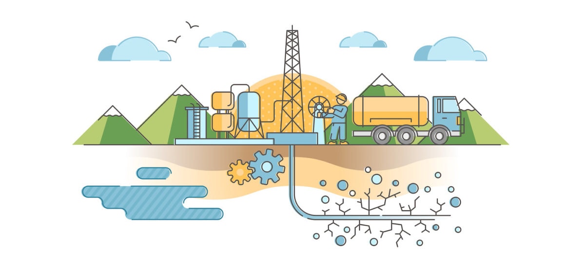
The Fracking Truth About Hydraulic Fracturing
Read about differing opinions about the hydraulic fracturing "fracking" technique used for shale gas extraction.
Hydrology
The Other Extreme : the Measurement of Water Flow
Most conversations about extreme measurements focus on flood flow. However, I recently had a conversation with Emily Huxter about her…
Hydrology
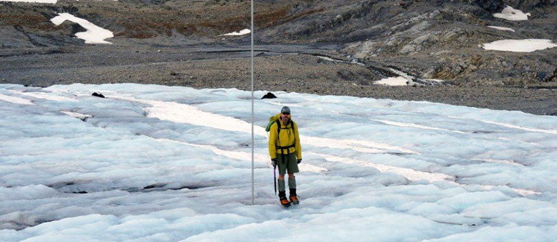
A Hydrologist’s Holiday
A 3-day hike in July on the Wapta Icefield in the Canadian Rockies with my son took us up the Bow Glacier, briefly onto the...
Hydrology
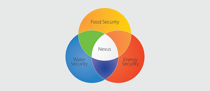
The Weaponization of Water Data
Every change in the expected pattern of variability of water supply and quality poses a threat to the security of the water, food and energy...
Hydrology
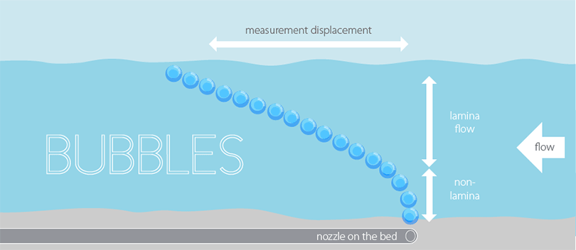
How to Get Better Flow Measurements Using the Rising Bubble Method
One objective of the Hydrology Corner is to provide a forum where hydrometric problems can be discussed and clever solutions to those problems can be...
Hydrology
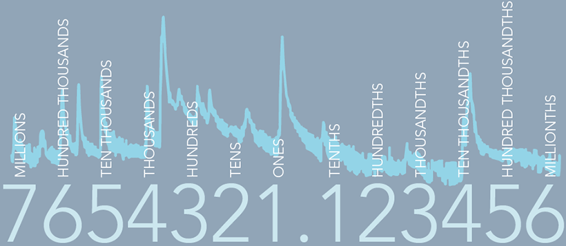
Data Rounding and Why You Should Care
To understand why modern data management systems store data to double precision we must consider the distinction between storing and reporting of data.
Hydrology
Extreme Gauging – How to Extend Rating Curves With Confidence
Extreme flows are extremely hard to gauge, hence we get very few gaugings to accurately define the top-end of stage-discharge rating curves. This is a...
Hydrology
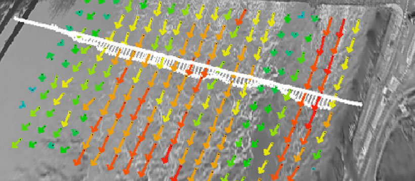
Drones – Providing a New Perspective on Hydrometry
Unmanned Aerial Vehicles (UAV) also known as drones, can be used for Large-Scale Particle Image Velocimetry to provide cross-sectional hydrometry info.